گالی (شهر) محتویات خصوصیات خواهرخوانده نگارخانه جستارهای وابسته منابع منوی ناوبری۶°۳′۱۳″ شمالی ۸۰°۱۲′۴۲″ شرقی / ۶٫۰۵۳۶۱°شمالی ۸۰٫۲۱۱۶۷°شرقی / 6.05361; 80.21167۶°۳′۱۳″ شمالی ۸۰°۱۲′۴۲″ شرقی / ۶٫۰۵۳۶۱°شمالی ۸۰٫۲۱۱۶۷°شرقی / 6.05361; 80.21167galle.mc.gov.lk«Galle»وگسترش آن
کلمبوسری جایاواردنپورا کوتهنگومبوکندی (سریلانکا)کالمونایواوونیاگالی (شهر)ینکومالیباتیکالواجافناKatunayakeدامبولاکولوناواانورادهاپوراراتناپورا
گالیمرکز استانها در سریلانکامیراث جهانی یونسکو در سریلانکا
لاتینشهرسریلانکااستان جنوبی (سریلانکا)کیلومترمربعفلسن
گالی (شهر)
پرش به ناوبری
پرش به جستجو
| گالی (شهر) | |
|---|---|
شهر | |
| گالی (شهر) | |
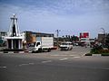
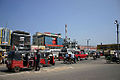
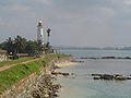
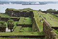
 Clockwise from top left: Galle Temple, Aerial view of Galle Fort، Interior of the Galle Fort, St. Aloysius College, Galle View of the Galle International Stadium from the Fort, Dutch Reformed Church of Galle, Galle Municipal Council | |
  گالی (شهر) موقعیت گالی (شهر) در نقشه | |
مختصات: ۶°۳′۱۳″ شمالی ۸۰°۱۲′۴۲″ شرقی / ۶٫۰۵۳۶۱°شمالی ۸۰٫۲۱۱۶۷°شرقی / 6.05361; 80.21167مختصات: ۶°۳′۱۳″ شمالی ۸۰°۱۲′۴۲″ شرقی / ۶٫۰۵۳۶۱°شمالی ۸۰٫۲۱۱۶۷°شرقی / 6.05361; 80.21167 | |
| کشور | Sri Lanka |
| استان | استان جنوبی (سریلانکا) |
حکومت | |
| • نوع | Galle Municipal Council |
| • شهردار | Methsiri De Silva |
| • Headquarters | Galle Town Hall |
| مساحت | |
| • کل | ۱۶٫۵۲ کیلومتر مربع (۶٫۴ مایل مربع) |
ارتفاع | ۰ متر (۰ پا) |
| جمعیت (۲۰۱۱) | |
| • جمعیت | ۹۹٬۴۷۸ |
| • تراکم | ۵٬۷۱۲/km۲ (۱۴٬۷۹۰/sq mi) |
| نام اهلیت | Galleans |
| منطقهٔ زمانی | Sri Lanka Standard Time Zone (یوتیسی +۵:۳۰) |
| پیششماره(های) تلفن | ۰۹۱ |
| وبگاه | galle.mc.gov.lk |
گالی (به لاتین: Galle) یک شهر در سریلانکا است که در استان جنوبی (سریلانکا) واقع شدهاست.[۱]
محتویات
۱ خصوصیات
۲ خواهرخوانده
۳ نگارخانه
۴ جستارهای وابسته
۵ منابع
خصوصیات
گالی ۱۶٫۵۲ کیلومترمربع مساحت و ۹۹٬۴۷۸ نفر جمعیت دارد و ۰ متر بالاتر از سطح دریا واقع شدهاست.
خواهرخوانده
شهر فلسن خواهرخواندهٔ گالی (شهر) هست.
نگارخانه




جستارهای وابسته
- فهرست شهرهای سریلانکا
منابع
↑ مشارکت کنندگان ویکیپدیای انگلیسی. «Galle».
 | این یک مقالهٔ خرد پیرامون سریلانکا است. با گسترش آن به ویکیپدیا کمک کنید. |
ردهها:
- گالی
- مرکز استانها در سریلانکا
- میراث جهانی یونسکو در سریلانکا


(window.RLQ=window.RLQ||[]).push(function()mw.config.set("wgPageParseReport":"limitreport":"cputime":"0.412","walltime":"0.554","ppvisitednodes":"value":4267,"limit":1000000,"ppgeneratednodes":"value":0,"limit":1500000,"postexpandincludesize":"value":55350,"limit":2097152,"templateargumentsize":"value":6228,"limit":2097152,"expansiondepth":"value":28,"limit":40,"expensivefunctioncount":"value":1,"limit":500,"unstrip-depth":"value":0,"limit":20,"unstrip-size":"value":9193,"limit":5000000,"entityaccesscount":"value":1,"limit":400,"timingprofile":["100.00% 494.456 1 -total"," 60.42% 298.737 1 الگو:Infobox_settlement"," 46.83% 231.570 2 الگو:Infobox"," 17.07% 84.395 1 الگو:پانویس"," 15.95% 78.884 1 الگو:یادکرد_وب"," 14.10% 69.705 1 الگو:یادکرد/هسته"," 10.39% 51.386 1 الگو:Geobox_coor"," 9.66% 47.772 1 الگو:Coord"," 9.55% 47.225 1 الگو:Infobox_settlement/areadisp"," 8.83% 43.650 3 الگو:Infobox_settlement/metric"],"scribunto":"limitreport-timeusage":"value":"0.095","limit":"10.000","limitreport-memusage":"value":2512883,"limit":52428800,"cachereport":"origin":"mw1269","timestamp":"20190306061217","ttl":2592000,"transientcontent":false);mw.config.set("wgBackendResponseTime":127,"wgHostname":"mw1239"););


